Jump To…
- History of Durham
- Schools
- Durham Eureka Community Center
- Local Business
- Rivers & Parks
- Visitors & Residents
History of Durham
Getting Settled
Durham lies within the broad charter granted in 1620 by James I to the Council of Plymouth, a group of 40 noblemen and gentlemen. It, in turn, sold the land to various men whose holdings were further enlarged by a deed from six of the American Indian chiefs (Warumbee, Darumkine, Wihikermet, Domhegon, Heonogasset, and Numbenemet). Later, a group of gentlemen and Boston financiers known as the Pejebscot Proprietors gained a patent for the vast lands along the Androscoggin River, including what is now Harpswell, all the way through Brunswick and up to Auburn. Much of this was uninhabited until the British victory in 1759.
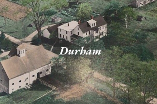
The second tier of settlements followed long after the coastal ones. In a deed dated November 14, 1761, David Dunning purchased for 33 pounds six square miles of land to be laid out as a town to be named Royalsborough (later Durham). Royalsborough was named after British General Isaac Royal, who owned a large tract of land near the mouth of the Royal River. Royalston, Massachusetts also bears his name. Loyal to Britain, the Royal family left the area at the start of the Revolutionary War.
Getting Organized
In 1766 Jonathan Bagley and Moses Little were appointed by the Pejebscot Proprietors as a committee which would lay out a road and build a log house for the settlement; the Proprietors often made such improvements to persuade settlers to purchase lots. The Proprietors met again in 1767, establishing a plantation to be named Royalsborough and to be surveyed into 96 lots.
- The earliest settler was Samuel Gerrish (Gerrish’s Mill), about 1769. Other early settlers included Judah Chandler, Cushing, Isaac Bagley, and Ebenezer Newell. Each cleared a home lot, burning the trees and using the ashes to nourish first plantings. Primitive logging roads were carved out of the forests to get logs to coastal towns. Trails or rough roads were laid out to Harriseeket (Freeport), to what became Auburn to the north, and west to North Yarmouth and Falmouth.
- In 1768 the Proprietors appointed Jonathan Bagley, Moses Little, and Belcher Noyes as a committee to attract settlers. The first 10 deeds were granted in 1770; by 1776, 25 settlers were occupying their own lots.
- At several meetings the settlers discussed “Some Method for Entering into some order in Said Town.” Although proposals to become a town were made in 1782 and 1783, the group voted against it in 1784 and 1786. Then, in a petition to the Massachusetts General Court on February 4, 1788 that described at length the privations suffered during the war, the settlers asked forgiveness for back taxes and for incorporation into a town named Sharon “that we may be in a capacity of enjoying those civil and religious privileges which other towns enjoy, which if rightly improved will make us a happy people.” The General Court on February 17, 1789 voted to establish a town named Durham. It often happened that names would thus be arbitrarily chosen. At that time the town had about 70 families and claimed 700 people.
Durham held its first Town Meeting on March 17, 1789, and began its struggles to bring in the benefits of civilization like roads, schools, and industry.
Doing Business
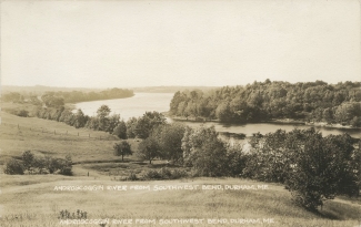
Even before their settlement, the interior towns were ransacked of timber. Although small mills were set up on Chandler’s Stream and Meadow Brook, the settlement lacked the water power that later powered mills in bordering towns. Potash was manufactured early, extracting potassium compounds from wood ashes. Trees were milled into lumber, but saw mills had low capacity. Oak bark was used in tanneries to turn cow hides into leather, and that leather was made into harnesses and shoes.
- Shoemaking was a substantial cottage industry as early as 1820; men and women worked on patterns and lasts provided out of Lynn factories. At the height of the shoe industry, more than 300 men and women were employed in small shops of usually five or six workers. Farms provided milk and vegetables to families in other towns. The town’s economic problem remained the scarcity of cash from the sale of exportable goods. Town obligations such as roads and schools were often met by citizens’ labor in lieu of money tax payments.
- Before the Civil War, the River Road/South Bend vicinity became a trading center for a region stretching 20 miles or more northward at a time when Lewiston and Auburn had no industrial or commercial importance. Each section of town had its general store; O. Israel Bagley opened the first one in 1770, just south of where the Bagley Inn stands today. These general stores were community gathering spots where gossip, political arguments and exchanges of work were shared.
- At Durham’s height as a commercial center, stores around the South Bend also included a millinery, a bakery, a hotel, a tavern and an apothecary. People stopped in at their general store almost daily to pick up mail.
- With unanticipated consequences, the RFD mail service (established in 1920) eliminated this commerce. Without people coming into town to pick up their mail, the small stores of Durham no longer could compete with shops in Freeport, Brunswick and Auburn.
To learn more about the history of Durham, see Everett Stackpole’s History of Durham (1896), Durham Bicentennial Reports (1976 and 1989), or contact the Durham Historical Society.
(Back to top)Schools
Durham Community School
- Address: 654 Hallowell Road, Durham, ME 04222
- Phone: 207-353-9333
- Website: Click Here
Freeport High School
- Address: 30 Holbrook Street, Freeport, ME 04032
- Phone: 207-865-4706
- Website: Click Here
Durham Eureka Community Center
- Address: 606 Hallowell Road, Durham, ME 04222
About
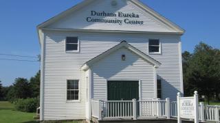
The Eureka Grange #7 was organized in 1874 and the old grange hall was built in 1906. The building is no longer used as a grange organization, but it has since been restored for use as the Durham Eureka Community Center. It sits at the intersection of Routes 9 and 136, across the street from the Durham Fire and Rescue building.
Rentals
The Eureka Community Center is available to rent for gatherings of 50 people or less. If you are interested in holding an event at the Eureka Community Center or would like to suggest an event to be held there, contact the Durham Town Office at (207) 353-2561.
- Eureka Community Center Rental Agreement
- Pearl Scribner, Calendar Manager – Call or text (207)754-5912
Eureka Community Center Rental Insurance
Insurance must be obtained for rentals of the Eureka Community Center.
- Renters can call their Homeowner’s Insurance Company and have them fax the Town Office a special event rider naming the Town of Durham as additionally insured. Homeowner’s Insurance Policies must contain a liability amount of at least $400,000 per single occurrence.
- Renters can obtain insurance for their event through a third-party vendor, GatherGuard. Click HERE to access their website. They will ask for a Town Venue Code/Venue Location Code: 0419/042 The cost starts at approximately $120 per event and must be paid for with a credit card.
Eureka Community Center Rental Insurance Information
(Back to top)Local Business
Durham is a beautiful place to live and do business. With an abundance of natural resources, Durham offers a central Maine location that is a little off the beaten path for quiet and peaceful surroundings, yet sandwiched between both the Maine Turnpike and I-295, the central nerves for commerce within the State of Maine.
Durham’s current population is approximately 4,353, offering new businesses a large pool of potential customers. Center Durham is located about 10-12 miles from either highway for businesses that need to move cargo or freight to and from their facilities. Durham currently has more than 30 established businesses to support local needs.
Getting a new business started in Durham, or moving an existing business here may require a meeting with the Planning Board.
(Back to top)Rivers & Parks
Durham River Park
Activities:
- Canoeing, Kayaking, Nature Trail, Picnic Area
Location:
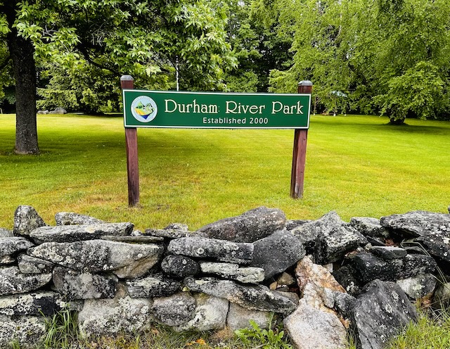
- Directions: On Route 136, along the Androscoggin River. From the Durham intersection of Route 136 and Route 9 (Newell Brook Road and Royalsborough Road), follow 136 north .5 miles. The park will be on your right. Runaround Pond abuts private property, so please use consideration when paddling or fishing.
- Durham River Park Map
Rules & Permit:
Contact:
- Durham Town Office or Androscoggin Land Trust
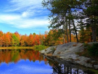
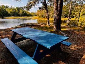
Runaround Pond
 ,
,  ]
]
Location:
Activities:
- Boat launch, canoeing, kayaking, hiking, cross-country skiing, snowshoeing, picnic area
Contact:
- Durham Town Office
- Address: 630 Hallowell Road, Durham, Maine 04222
- Phone: 207-353-2561
Visitors & Residents
Come Visit
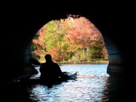
- Durham has an abundance of beautiful places. We invite visitors to delight in our natural treasures, explore our town and participate in local events. Whether it’s our fascinating history that captures your attention, or our natural beauty, we hope you enjoy your time with us!
Come Stay
- Our town is a great place to call home. Our citizens are active in shaping and deciding the issues that impact our lives—from volunteering in the community to participating in town meetings. Welcome to life in Durham!